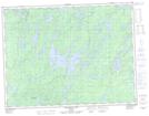
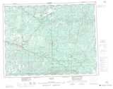
Maps showing Peat Creek, Thunder Bay, Ontario
Peat Creek is a River located in Thunder Bay, Ontario and has an elevation of 503 meters.
- Latitude: 49° 18' 9'' North (decimal: 49.3024999)
- Longitude: 90° 21' 22'' West (decimal: -90.3561111)
- Topography Feature Category: River
- Geographical Feature: Creek
- Canadian Province/Territory: Ontario
- Elevation: 503 meters
- Location: Thunder Bay
- Atlas of Canada Locator Map: Peat Creek
- GPS Coordinate Locator Map: Peat Creek Lat/Long
Peat Creek NTS Map Sheets