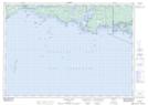
Maps showing Northeast Point, Manitoulin, Ontario
Northeast Point is a Cape located in Manitoulin, Ontario.
- Latitude: 45° 57' 52'' North (decimal: 45.9643999)
- Longitude: 81° 29' 53'' West (decimal: -81.4981000)
- Topography Feature Category: Cape
- Geographical Feature: Point
- Canadian Province/Territory: Ontario
- Location: Manitoulin
- Atlas of Canada Locator Map: Northeast Point
- GPS Coordinate Locator Map: Northeast Point Lat/Long
Northeast Point NTS Map Sheets