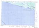
Maps showing North Point Shoal, Algoma, Ontario
North Point Shoal is a Shoal located in Algoma, Ontario.
- Latitude: 46° 6' 58'' North (decimal: 46.1161111)
- Longitude: 83° 0' 38'' West (decimal: -83.0105555)
- Topography Feature Category: Shoal
- Geographical Feature: Shoal
- Canadian Province/Territory: Ontario
- Location: Algoma
- Atlas of Canada Locator Map: North Point Shoal
- GPS Coordinate Locator Map: North Point Shoal Lat/Long
North Point Shoal NTS Map Sheets