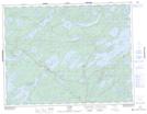
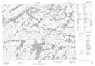
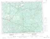
Maps showing Dominion Creek, Ontario
Dominion Creek is a River located in Ontario and has an elevation of 413 meters.
- Latitude: 50° 3' 23'' North (decimal: 50.0564000)
- Longitude: 91° 19' 14'' West (decimal: -91.3206000)
- Topography Feature Category: River
- Geographical Feature: Creek
- Canadian Province/Territory: Ontario
- Elevation: 413 meters
- GPS Coordinate Locator Map: Dominion Creek Lat/Long
Dominion Creek NTS Map Sheets