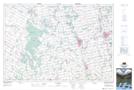
Maps showing Douglas Hill, Bruce, Ontario
Douglas Hill is a Mountain located in Bruce, Ontario and has an elevation of 251 meters.
- Latitude: 44° 12' 40'' North (decimal: 44.2111111)
- Longitude: 81° 13' 54'' West (decimal: -81.2316666)
- Topography Feature Category: Mountain
- Geographical Feature: Hill
- Canadian Province/Territory: Ontario
- Elevation: 251 meters
- Location: Bruce
- Atlas of Canada Locator Map: Douglas Hill
- GPS Coordinate Locator Map: Douglas Hill Lat/Long
Douglas Hill NTS Map Sheets