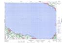
Maps showing Dow Bay, Simcoe, Ontario
Dow Bay is a Bay located in Simcoe, Ontario and has an elevation of 180 meters.
- Latitude: 44° 42' 30'' North (decimal: 44.7083333)
- Longitude: 80° 0' 55'' West (decimal: -80.0152777)
- Topography Feature Category: Bay
- Geographical Feature: Bay
- Canadian Province/Territory: Ontario
- Elevation: 180 meters
- Location: Simcoe
- Atlas of Canada Locator Map: Dow Bay
- GPS Coordinate Locator Map: Dow Bay Lat/Long
Dow Bay NTS Map Sheets