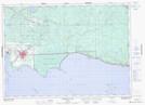
Maps showing Duchesnay Creek, Nipissing, Ontario
Duchesnay Creek is a River located in Nipissing, Ontario and has an elevation of 308 meters.
- Latitude: 46° 19' 40'' North (decimal: 46.3277777)
- Longitude: 79° 30' 14'' West (decimal: -79.5038888)
- Topography Feature Category: River
- Geographical Feature: Creek
- Canadian Province/Territory: Ontario
- Elevation: 308 meters
- Location: Nipissing
- Atlas of Canada Locator Map: Duchesnay Creek
- GPS Coordinate Locator Map: Duchesnay Creek Lat/Long
Duchesnay Creek NTS Map Sheets