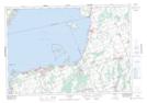
Maps showing Duclos Point, York, Ontario
Duclos Point is a Unincorporated area located in York, Ontario and has an elevation of 230 meters.
- Latitude: 44° 21' 4'' North (decimal: 44.3511111)
- Longitude: 79° 14' 59'' West (decimal: -79.2497222)
- Topography Feature Category: Unincorporated area
- Geographical Feature: Dispersed Rural Community
- Canadian Province/Territory: Ontario
- Elevation: 230 meters
- Location: York
- Atlas of Canada Locator Map: Duclos Point
- GPS Coordinate Locator Map: Duclos Point Lat/Long
Duclos Point NTS Map Sheets