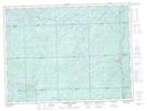
Maps showing Dumas, Algoma, Ontario
Dumas is a Geographical area located in Algoma, Ontario.
- Latitude: 48° 19' 31'' North (decimal: 48.3252777)
- Longitude: 84° 44' 16'' West (decimal: -84.7377777)
- Topography Feature Category: Geographical area
- Geographical Feature: Geographic Township
- Canadian Province/Territory: Ontario
- Location: Algoma
- Atlas of Canada Locator Map: Dumas
- GPS Coordinate Locator Map: Dumas Lat/Long
Dumas NTS Map Sheets