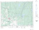
Maps showing Dunbar Rock, Timiskaming, Ontario
Dunbar Rock is a Mountain located in Timiskaming, Ontario and has an elevation of 289 meters.
- Latitude: 47° 45' 19'' North (decimal: 47.7552777)
- Longitude: 79° 56' 51'' West (decimal: -79.9474999)
- Topography Feature Category: Mountain
- Geographical Feature: Hill
- Canadian Province/Territory: Ontario
- Elevation: 289 meters
- Location: Timiskaming
- Atlas of Canada Locator Map: Dunbar Rock
- GPS Coordinate Locator Map: Dunbar Rock Lat/Long
Dunbar Rock NTS Map Sheets