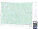
Maps showing Dwyer Marsh, Frontenac, Ontario
Dwyer Marsh is a Low vegetation located in Frontenac, Ontario and has an elevation of 269 meters.
- Latitude: 45° 4' 18'' North (decimal: 45.0716666)
- Longitude: 76° 50' 36'' West (decimal: -76.8433333)
- Topography Feature Category: Low vegetation
- Geographical Feature: Marsh
- Canadian Province/Territory: Ontario
- Elevation: 269 meters
- Location: Frontenac
- Atlas of Canada Locator Map: Dwyer Marsh
- GPS Coordinate Locator Map: Dwyer Marsh Lat/Long
Dwyer Marsh NTS Map Sheets