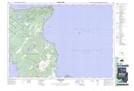
Maps showing Dyer's Bay, Bruce, Ontario
Dyer's Bay is a Unincorporated area located in Bruce, Ontario and has an elevation of 185 meters.
- Latitude: 45° 9' 47'' North (decimal: 45.1630555)
- Longitude: 81° 20' 20'' West (decimal: -81.3388888)
- Topography Feature Category: Unincorporated area
- Geographical Feature: Dispersed Rural Community
- Canadian Province/Territory: Ontario
- Elevation: 185 meters
- Location: Bruce
- Atlas of Canada Locator Map: Dyer's Bay
- GPS Coordinate Locator Map: Dyer's Bay Lat/Long
Dyer's Bay NTS Map Sheets