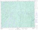
Maps showing Dying Portage, Thunder Bay, Ontario
Dying Portage is a Road feature located in Thunder Bay, Ontario.
- Latitude: 49° 22' 23'' North (decimal: 49.3730555)
- Longitude: 86° 5' 15'' West (decimal: -86.0875000)
- Topography Feature Category: Road feature
- Geographical Feature: Portage
- Canadian Province/Territory: Ontario
- Location: Thunder Bay
- Atlas of Canada Locator Map: Dying Portage
- GPS Coordinate Locator Map: Dying Portage Lat/Long
Dying Portage NTS Map Sheets