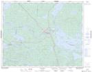
Maps showing Ear Falls, Kenora, Ontario
Ear Falls is a Unincorporated area located in Kenora, Ontario and has an elevation of 351 meters.
- Latitude: 50° 38' 16'' North (decimal: 50.6377777)
- Longitude: 93° 14' 10'' West (decimal: -93.2361111)
- Topography Feature Category: Unincorporated area
- Geographical Feature: Compact Rural Community
- Canadian Province/Territory: Ontario
- Elevation: 351 meters
- Location: Kenora
- Atlas of Canada Locator Map: Ear Falls
- GPS Coordinate Locator Map: Ear Falls Lat/Long