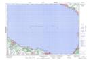
Maps showing East Black Bass Bay, Simcoe, Ontario
East Black Bass Bay is a Bay located in Simcoe, Ontario and has an elevation of 176 meters.
- Latitude: 44° 31' 38'' North (decimal: 44.5272222)
- Longitude: 80° 16' 28'' West (decimal: -80.2744444)
- Topography Feature Category: Bay
- Geographical Feature: Bay
- Canadian Province/Territory: Ontario
- Elevation: 176 meters
- Location: Simcoe
- Atlas of Canada Locator Map: East Black Bass Bay
- GPS Coordinate Locator Map: East Black Bass Bay Lat/Long
East Black Bass Bay NTS Map Sheets