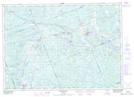
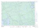
Maps showing East Burpee, Parry Sound, Ontario
East Burpee is a Geographical area located in Parry Sound, Ontario.
- Latitude: 45° 34' 58'' North (decimal: 45.5827777)
- Longitude: 80° 6' 27'' West (decimal: -80.1074999)
- Topography Feature Category: Geographical area
- Geographical Feature: Geographic Township
- Canadian Province/Territory: Ontario
- Location: Parry Sound
- Atlas of Canada Locator Map: East Burpee
- GPS Coordinate Locator Map: East Burpee Lat/Long
East Burpee NTS Map Sheets