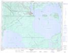
Maps showing East Little Ruby Creek, Thunder Bay, Ontario
East Little Ruby Creek is a River located in Thunder Bay, Ontario and has an elevation of 197 meters.
- Latitude: 48° 59' 29'' North (decimal: 48.9913888)
- Longitude: 88° 9' 36'' West (decimal: -88.1599999)
- Topography Feature Category: River
- Geographical Feature: Creek
- Canadian Province/Territory: Ontario
- Elevation: 197 meters
- Location: Thunder Bay
- Atlas of Canada Locator Map: East Little Ruby Creek
- GPS Coordinate Locator Map: East Little Ruby Creek Lat/Long
East Little Ruby Creek NTS Map Sheets