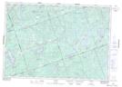
Maps showing Egan Creek, Hastings, Ontario
Egan Creek is a Unincorporated area located in Hastings, Ontario and has an elevation of 345 meters.
- Latitude: 44° 57' 56'' North (decimal: 44.9655555)
- Longitude: 77° 43' 43'' West (decimal: -77.7286111)
- Topography Feature Category: Unincorporated area
- Geographical Feature: Railway Point
- Canadian Province/Territory: Ontario
- Elevation: 345 meters
- Location: Hastings
- Atlas of Canada Locator Map: Egan Creek
- GPS Coordinate Locator Map: Egan Creek Lat/Long