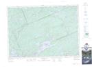
Maps showing Eighteen Mile Lake, Haliburton; Muskoka, Ontario
Eighteen Mile Lake is a Lake located in Haliburton; Muskoka, Ontario and has an elevation of 380 meters.
- Latitude: 45° 22' 58'' North (decimal: 45.3827777)
- Longitude: 78° 57' 45'' West (decimal: -78.9625000)
- Topography Feature Category: Lake
- Geographical Feature: Lake
- Canadian Province/Territory: Ontario
- Elevation: 380 meters
- Location: Haliburton; Muskoka
- Atlas of Canada Locator Map: Eighteen Mile Lake
- GPS Coordinate Locator Map: Eighteen Mile Lake Lat/Long
Eighteen Mile Lake NTS Map Sheets