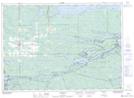
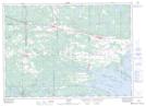
Maps showing The Elbow, Sudbury, Ontario
The Elbow is a Cape located in Sudbury, Ontario and has an elevation of 204 meters.
- Latitude: 46° 14' 58'' North (decimal: 46.2494444)
- Longitude: 80° 21' 21'' West (decimal: -80.3558333)
- Topography Feature Category: Cape
- Geographical Feature: Point
- Canadian Province/Territory: Ontario
- Elevation: 204 meters
- Location: Sudbury
- Atlas of Canada Locator Map: The Elbow
- GPS Coordinate Locator Map: The Elbow Lat/Long
The Elbow NTS Map Sheets