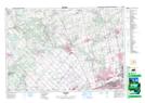
Maps showing Elder Mills, York, Ontario
Elder Mills is a Unincorporated area located in York, Ontario and has an elevation of 172 meters.
- Latitude: 43° 48' 24'' North (decimal: 43.8066666)
- Longitude: 79° 37' 51'' West (decimal: -79.6308333)
- Topography Feature Category: Unincorporated area
- Geographical Feature: Dispersed Rural Community
- Canadian Province/Territory: Ontario
- Elevation: 172 meters
- Location: York
- Atlas of Canada Locator Map: Elder Mills
- GPS Coordinate Locator Map: Elder Mills Lat/Long