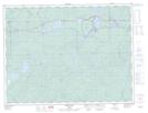
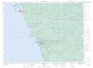
Maps showing Ell Lake, Thunder Bay, Ontario
Ell Lake is a Lake located in Thunder Bay, Ontario and has an elevation of 317 meters.
- Latitude: 48° 38' 52'' North (decimal: 48.6477777)
- Longitude: 85° 59' 41'' West (decimal: -85.9947222)
- Topography Feature Category: Lake
- Geographical Feature: Lake
- Canadian Province/Territory: Ontario
- Elevation: 317 meters
- Location: Thunder Bay
- Atlas of Canada Locator Map: Ell Lake
- GPS Coordinate Locator Map: Ell Lake Lat/Long
Ell Lake NTS Map Sheets