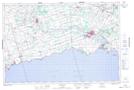
Maps showing Ellsworth Drain, Welland, Ontario
Ellsworth Drain is a Hydraulic construction located in Welland, Ontario and has an elevation of 178 meters.
- Latitude: 42° 56' 58'' North (decimal: 42.9494444)
- Longitude: 79° 27' 2'' West (decimal: -79.4505555)
- Topography Feature Category: Hydraulic construction
- Geographical Feature: Drain
- Canadian Province/Territory: Ontario
- Elevation: 178 meters
- Location: Welland
- Atlas of Canada Locator Map: Ellsworth Drain
- GPS Coordinate Locator Map: Ellsworth Drain Lat/Long
Ellsworth Drain NTS Map Sheets