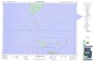
Maps showing Emily Maxwell Reef, Manitoulin, Ontario
Emily Maxwell Reef is a Shoal located in Manitoulin, Ontario.
- Latitude: 45° 26' 27'' North (decimal: 45.4408333)
- Longitude: 81° 49' 54'' West (decimal: -81.8316666)
- Topography Feature Category: Shoal
- Geographical Feature: Reef
- Canadian Province/Territory: Ontario
- Location: Manitoulin
- Atlas of Canada Locator Map: Emily Maxwell Reef
- GPS Coordinate Locator Map: Emily Maxwell Reef Lat/Long
Emily Maxwell Reef NTS Map Sheets