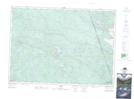
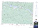
Maps showing Emma Creek, Nipissing, Ontario
Emma Creek is a River located in Nipissing, Ontario and has an elevation of 235 meters.
- Latitude: 46° 0' 41'' North (decimal: 46.0113888)
- Longitude: 77° 43' 50'' West (decimal: -77.7305555)
- Topography Feature Category: River
- Geographical Feature: Creek
- Canadian Province/Territory: Ontario
- Elevation: 235 meters
- Location: Nipissing
- Atlas of Canada Locator Map: Emma Creek
- GPS Coordinate Locator Map: Emma Creek Lat/Long
Emma Creek NTS Map Sheets