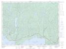
Maps showing Empress Hill, Thunder Bay, Ontario
Empress Hill is a Mountain located in Thunder Bay, Ontario and has an elevation of 335 meters.
- Latitude: 48° 51' 56'' North (decimal: 48.8655555)
- Longitude: 86° 59' 1'' West (decimal: -86.9836111)
- Topography Feature Category: Mountain
- Geographical Feature: Hill
- Canadian Province/Territory: Ontario
- Elevation: 335 meters
- Location: Thunder Bay
- Atlas of Canada Locator Map: Empress Hill
- GPS Coordinate Locator Map: Empress Hill Lat/Long