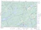
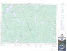
Maps showing Fairs Creek, Lanark, Ontario
Fairs Creek is a River located in Lanark, Ontario and has an elevation of 180 meters.
- Latitude: 44° 58' 30'' North (decimal: 44.9750000)
- Longitude: 76° 30' 54'' West (decimal: -76.5149999)
- Topography Feature Category: River
- Geographical Feature: Creek
- Canadian Province/Territory: Ontario
- Elevation: 180 meters
- Location: Lanark
- Atlas of Canada Locator Map: Fairs Creek
- GPS Coordinate Locator Map: Fairs Creek Lat/Long
Fairs Creek NTS Map Sheets