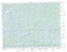
Maps showing Fallenrock Point, Rainy River, Ontario
Fallenrock Point is a Cape located in Rainy River, Ontario and has an elevation of 419 meters.
- Latitude: 48° 54' 37'' North (decimal: 48.9102777)
- Longitude: 91° 24' 45'' West (decimal: -91.4125000)
- Topography Feature Category: Cape
- Geographical Feature: Point
- Canadian Province/Territory: Ontario
- Elevation: 419 meters
- Location: Rainy River
- Atlas of Canada Locator Map: Fallenrock Point
- GPS Coordinate Locator Map: Fallenrock Point Lat/Long