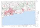
Maps showing Farewell Creek, Ontario, Ontario
Farewell Creek is a River located in Ontario, Ontario and has an elevation of 76 meters.
- Latitude: 43° 52' 51'' North (decimal: 43.8808333)
- Longitude: 78° 49' 18'' West (decimal: -78.8216666)
- Topography Feature Category: River
- Geographical Feature: Creek
- Canadian Province/Territory: Ontario
- Elevation: 76 meters
- Location: Ontario
- Atlas of Canada Locator Map: Farewell Creek
- GPS Coordinate Locator Map: Farewell Creek Lat/Long