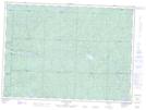
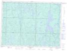
Maps showing Farewell Creek, Sudbury, Ontario
Farewell Creek is a River located in Sudbury, Ontario and has an elevation of 442 meters.
- Latitude: 47° 23' 40'' North (decimal: 47.3944444)
- Longitude: 83° 41' 28'' West (decimal: -83.6911111)
- Topography Feature Category: River
- Geographical Feature: Creek
- Canadian Province/Territory: Ontario
- Elevation: 442 meters
- Location: Sudbury
- Atlas of Canada Locator Map: Farewell Creek
- GPS Coordinate Locator Map: Farewell Creek Lat/Long
Farewell Creek NTS Map Sheets