Maps showing Fells Hill, Grenville, Ontario
Fells Hill is a Mountain located in Grenville, Ontario and has an elevation of 107 meters.
- Latitude: 44° 45' 14'' North (decimal: 44.7538888)
- Longitude: 75° 32' 52'' West (decimal: -75.5477777)
- Topography Feature Category: Mountain
- Geographical Feature: Hill
- Canadian Province/Territory: Ontario
- Elevation: 107 meters
- Location: Grenville
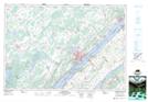
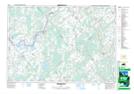
- Atlas of Canada Locator Map: Fells Hill
- GPS Coordinate Locator Map: Fells Hill Lat/Long
Fells Hill NTS Map Sheets