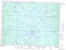
Maps showing Five Mile Lake Provincial Park, Sudbury, Ontario
Five Mile Lake Provincial Park is a Conservation area located in Sudbury, Ontario and has an elevation of 458 meters.
- Latitude: 47° 34' 25'' North (decimal: 47.5736111)
- Longitude: 83° 13' 48'' West (decimal: -83.2300000)
- Topography Feature Category: Conservation area
- Geographical Feature: Provincial Park
- Canadian Province/Territory: Ontario
- Elevation: 458 meters
- Location: Sudbury
- Atlas of Canada Locator Map: Five Mile Lake Provincial Park
- GPS Coordinate Locator Map: Five Mile Lake Provincial Park Lat/Long