Maps showing Flagstaff Point, Kenora, Ontario
Flagstaff Point is a Cape located in Kenora, Ontario.
- Latitude: 55° 16' 25'' North (decimal: 55.2736111)
- Longitude: 85° 2' 45'' West (decimal: -85.0458333)
- Topography Feature Category: Cape
- Geographical Feature: Point
- Canadian Province/Territory: Ontario
- Location: Kenora
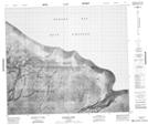
- Atlas of Canada Locator Map: Flagstaff Point
- GPS Coordinate Locator Map: Flagstaff Point Lat/Long
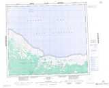
Flagstaff Point NTS Map Sheets