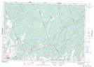
Maps showing Flinton Creek, Hastings; Lennox and Addington, Ontario
Flinton Creek is a River located in Hastings; Lennox and Addington, Ontario and has an elevation of 194 meters.
- Latitude: 44° 36' 34'' North (decimal: 44.6094444)
- Longitude: 77° 14' 20'' West (decimal: -77.2388888)
- Topography Feature Category: River
- Geographical Feature: Creek
- Canadian Province/Territory: Ontario
- Elevation: 194 meters
- Location: Hastings; Lennox and Addington
- Atlas of Canada Locator Map: Flinton Creek
- GPS Coordinate Locator Map: Flinton Creek Lat/Long