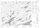
Maps showing Fork Creek, Kenora, Ontario
Fork Creek is a River located in Kenora, Ontario and has an elevation of 417 meters.
- Latitude: 50° 43' 8'' North (decimal: 50.7188888)
- Longitude: 92° 31' 48'' West (decimal: -92.5299999)
- Topography Feature Category: River
- Geographical Feature: Creek
- Canadian Province/Territory: Ontario
- Elevation: 417 meters
- Location: Kenora
- Atlas of Canada Locator Map: Fork Creek
- GPS Coordinate Locator Map: Fork Creek Lat/Long
Fork Creek NTS Map Sheets