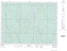
Maps showing Forks, Sudbury, Ontario
Forks is a Unincorporated area located in Sudbury, Ontario.
- Latitude: 47° 2' 58'' North (decimal: 47.0494444)
- Longitude: 81° 51' 53'' West (decimal: -81.8647222)
- Topography Feature Category: Unincorporated area
- Geographical Feature: Railway Point
- Canadian Province/Territory: Ontario
- Location: Sudbury
- Atlas of Canada Locator Map: Forks
- GPS Coordinate Locator Map: Forks Lat/Long
Forks NTS Map Sheets