Maps showing Foster Lake, Kenora, Ontario
Foster Lake is a Lake located in Kenora, Ontario.
- Latitude: 54° 30' 4'' North (decimal: 54.5011111)
- Longitude: 91° 23' 3'' West (decimal: -91.3841666)
- Topography Feature Category: Lake
- Geographical Feature: Lake
- Canadian Province/Territory: Ontario
- Location: Kenora
- Atlas of Canada Locator Map: Foster Lake
- GPS Coordinate Locator Map: Foster Lake Lat/Long
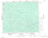
Foster Lake NTS Map Sheets