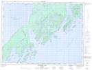
Maps showing Foxhound Rock, Thunder Bay, Ontario
Foxhound Rock is a Shoal located in Thunder Bay, Ontario.
- Latitude: 48° 43' 29'' North (decimal: 48.7247222)
- Longitude: 88° 24' 12'' West (decimal: -88.4033333)
- Topography Feature Category: Shoal
- Geographical Feature: Rock
- Canadian Province/Territory: Ontario
- Location: Thunder Bay
- Atlas of Canada Locator Map: Foxhound Rock
- GPS Coordinate Locator Map: Foxhound Rock Lat/Long
Foxhound Rock NTS Map Sheets