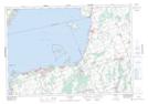
Maps showing Fox Island Shoal, York, Ontario
Fox Island Shoal is a Shoal located in York, Ontario.
- Latitude: 44° 20' 26'' North (decimal: 44.3405555)
- Longitude: 79° 28' 43'' West (decimal: -79.4786111)
- Topography Feature Category: Shoal
- Geographical Feature: Shoal
- Canadian Province/Territory: Ontario
- Location: York
- Atlas of Canada Locator Map: Fox Island Shoal
- GPS Coordinate Locator Map: Fox Island Shoal Lat/Long
Fox Island Shoal NTS Map Sheets