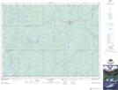
Maps showing Fox Rapids, Timiskaming, Ontario
Fox Rapids is a Rapids located in Timiskaming, Ontario and has an elevation of 309 meters.
- Latitude: 47° 56' 37'' North (decimal: 47.9436111)
- Longitude: 80° 36' 31'' West (decimal: -80.6086111)
- Topography Feature Category: Rapids
- Geographical Feature: Rapids
- Canadian Province/Territory: Ontario
- Elevation: 309 meters
- Location: Timiskaming
- Atlas of Canada Locator Map: Fox Rapids
- GPS Coordinate Locator Map: Fox Rapids Lat/Long