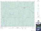
Maps showing Fraser Bay, Timiskaming, Ontario
Fraser Bay is a Bay located in Timiskaming, Ontario and has an elevation of 373 meters.
- Latitude: 47° 55' 25'' North (decimal: 47.9236111)
- Longitude: 80° 59' 21'' West (decimal: -80.9891666)
- Topography Feature Category: Bay
- Geographical Feature: Bay
- Canadian Province/Territory: Ontario
- Elevation: 373 meters
- Location: Timiskaming
- Atlas of Canada Locator Map: Fraser Bay
- GPS Coordinate Locator Map: Fraser Bay Lat/Long