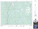
Maps showing Frederick Lake, Timiskaming, Ontario
Frederick Lake is a Lake located in Timiskaming, Ontario and has an elevation of 327 meters.
- Latitude: 47° 30' 26'' North (decimal: 47.5072222)
- Longitude: 80° 12' 10'' West (decimal: -80.2027777)
- Topography Feature Category: Lake
- Geographical Feature: Lake
- Canadian Province/Territory: Ontario
- Elevation: 327 meters
- Location: Timiskaming
- Atlas of Canada Locator Map: Frederick Lake
- GPS Coordinate Locator Map: Frederick Lake Lat/Long