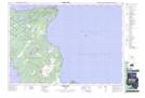
Maps showing French Harbour, Ontario
French Harbour is a Bay located in Ontario.
- Latitude: 45° 2' 47'' North (decimal: 45.0464000)
- Longitude: 81° 28' 45'' West (decimal: -81.4791999)
- Topography Feature Category: Bay
- Geographical Feature: Harbour
- Canadian Province/Territory: Ontario
- GPS Coordinate Locator Map: French Harbour Lat/Long
French Harbour NTS Map Sheets