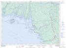
Maps showing French River, Parry Sound, Ontario
French River is a Unincorporated area located in Parry Sound, Ontario and has an elevation of 180 meters.
- Latitude: 45° 57' 51'' North (decimal: 45.9641666)
- Longitude: 80° 53' 31'' West (decimal: -80.8919444)
- Topography Feature Category: Unincorporated area
- Geographical Feature: Dispersed Rural Community
- Canadian Province/Territory: Ontario
- Elevation: 180 meters
- Location: Parry Sound
- Atlas of Canada Locator Map: French River
- GPS Coordinate Locator Map: French River Lat/Long
French River NTS Map Sheets