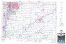
Maps showing Froomfield, Lambton, Ontario
Froomfield is a Unincorporated area located in Lambton, Ontario and has an elevation of 181 meters.
- Latitude: 42° 54' 49'' North (decimal: 42.9136111)
- Longitude: 82° 27' 15'' West (decimal: -82.4541666)
- Topography Feature Category: Unincorporated area
- Geographical Feature: Compact Rural Community
- Canadian Province/Territory: Ontario
- Elevation: 181 meters
- Location: Lambton
- Atlas of Canada Locator Map: Froomfield
- GPS Coordinate Locator Map: Froomfield Lat/Long