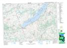
Maps showing Gage Creek, Durham; Northumberland, Ontario
Gage Creek is a River located in Durham; Northumberland, Ontario and has an elevation of 127 meters.
- Latitude: 43° 57' 5'' North (decimal: 43.9513888)
- Longitude: 78° 15' 46'' West (decimal: -78.2627777)
- Topography Feature Category: River
- Geographical Feature: Creek
- Canadian Province/Territory: Ontario
- Elevation: 127 meters
- Location: Durham; Northumberland
- Atlas of Canada Locator Map: Gage Creek
- GPS Coordinate Locator Map: Gage Creek Lat/Long
Gage Creek NTS Map Sheets