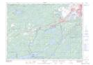
Maps showing Gatchell, Sudbury, Ontario
Gatchell is a Unincorporated area located in Sudbury, Ontario and has an elevation of 273 meters.
- Latitude: 46° 28' 33'' North (decimal: 46.4758333)
- Longitude: 81° 1' 32'' West (decimal: -81.0255555)
- Topography Feature Category: Unincorporated area
- Geographical Feature: Urban Community
- Canadian Province/Territory: Ontario
- Elevation: 273 meters
- Location: Sudbury
- Atlas of Canada Locator Map: Gatchell
- GPS Coordinate Locator Map: Gatchell Lat/Long
Gatchell NTS Map Sheets