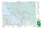
Maps showing Gem Island, Simcoe, Ontario
Gem Island is a Island located in Simcoe, Ontario.
- Latitude: 44° 51' 47'' North (decimal: 44.8630555)
- Longitude: 79° 41' 49'' West (decimal: -79.6969443)
- Topography Feature Category: Island
- Geographical Feature: Island
- Canadian Province/Territory: Ontario
- Location: Simcoe
- Atlas of Canada Locator Map: Gem Island
- GPS Coordinate Locator Map: Gem Island Lat/Long
Gem Island NTS Map Sheets