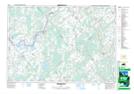
Maps showing Gemmells Point, Grenville, Ontario
Gemmells Point is a Cape located in Grenville, Ontario and has an elevation of 106 meters.
- Latitude: 44° 52' 2'' North (decimal: 44.8672222)
- Longitude: 75° 54' 21'' West (decimal: -75.9058333)
- Topography Feature Category: Cape
- Geographical Feature: Point
- Canadian Province/Territory: Ontario
- Elevation: 106 meters
- Location: Grenville
- Atlas of Canada Locator Map: Gemmells Point
- GPS Coordinate Locator Map: Gemmells Point Lat/Long
Gemmells Point NTS Map Sheets