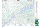
Maps showing Glen Becker, Dundas, Ontario
Glen Becker is a Unincorporated area located in Dundas, Ontario and has an elevation of 83 meters.
- Latitude: 44° 56' 5'' North (decimal: 44.9347222)
- Longitude: 75° 12' 49'' West (decimal: -75.2136111)
- Topography Feature Category: Unincorporated area
- Geographical Feature: Compact Rural Community
- Canadian Province/Territory: Ontario
- Elevation: 83 meters
- Location: Dundas
- Atlas of Canada Locator Map: Glen Becker
- GPS Coordinate Locator Map: Glen Becker Lat/Long
Glen Becker NTS Map Sheets